This is an edited version of the lecture I gave during the THB first anniversary treasure hunter's clinic. I have had a few requests to post it here, so here it is. I hope this helps a few of you find a new way to enjoy t-hunting.
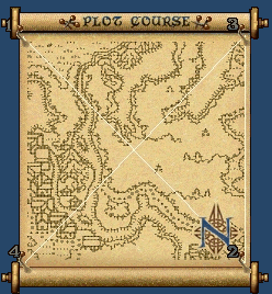
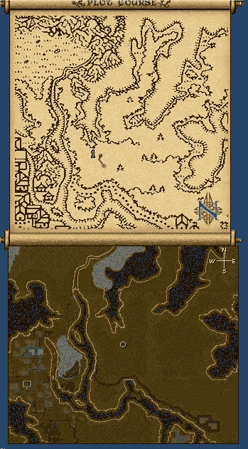
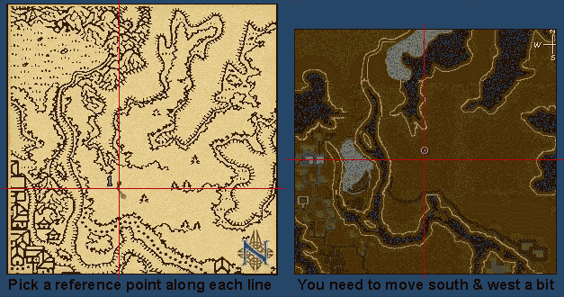
Why would anyone want to find a chest spot without using an archive? Good question. One reason is it may be necessary. If you can't access the archive for some reason, if the map you are looking for isn't there, or if it is but the coordinates are wrong, you either find the spot yourself or you don't dig up the treasure. Another reason of course is that you might find it fun. There is a certain satisfaction in it. And of course anyone who is seriously role playing a pure treasure hunter might consider it mandatory. I am going to go off on a tangent and take a little trip down memory lane here, looking at the early days of treasure hunting and the building of the archives in use today. Back when treasure hunting first started there was no such thing as a map archive. We all had to go out and find the chest spots on our own. There was a treasure hunter's board on the original Great Lakes Tribune, and the map archive associated with that is the first archive I was aware of. There was a bit of controversy back then over the best way to mark a spot. Many t-hunters took the coordinates after the chest was up while they stood to one side of it. Naturally, this resulted in the numbers being off by a small amount. Since all treasure hunters had mining in those days, it was not a big problem, but nevertheless, the numbers posted were not always 100% accurate. Some of the errors made back then may still be around in other archives, depending on where they got their information from and how much if any updating has been done to them. The Great Lakes Tribune archive is still in use today. It is the one that is found on the Crossroads of Britannia's site. Many of us who read the treasure hunter's board contributed coordinates to that archive. We had a lot of fun doing it, and it was a bit like a competition to see who could get a particular map in there first. I am going to tell you a couple of the methods we used to find those spots. First, I will assume you already know how to find the general location of a map; that is, is it near the crossroads? Which island is it on? etc. Comparing the treasure map to a larger map of Britannia can help you with that. So, you are in the general area, now what? Well, there are two ways you can do this. The first method requires you to bring along a few
blank maps. Yes, you can actually use cartography for something practical! *grins*
Using either of these methods will help you find any chest anywhere. Finding spots on your own can add a feeling of adventure and accomplishment, and also turn you from a treasure "digger" into a true treasure "hunter"! One thing to note: while it can be fun and rewarding to find the spots without an archive, it is NOT fun trying to do it while you have an eager party with you that is growing more impatient as you spend more time looking. That can make a very frustrating situation for you. If you are taking people with you, let them know what to expect. |